immobilie1-ID: 31071559 | Anbieter-ID: 24343142
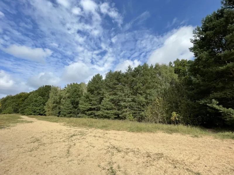
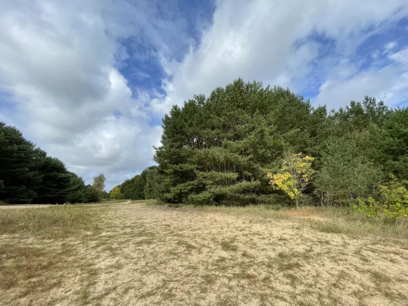
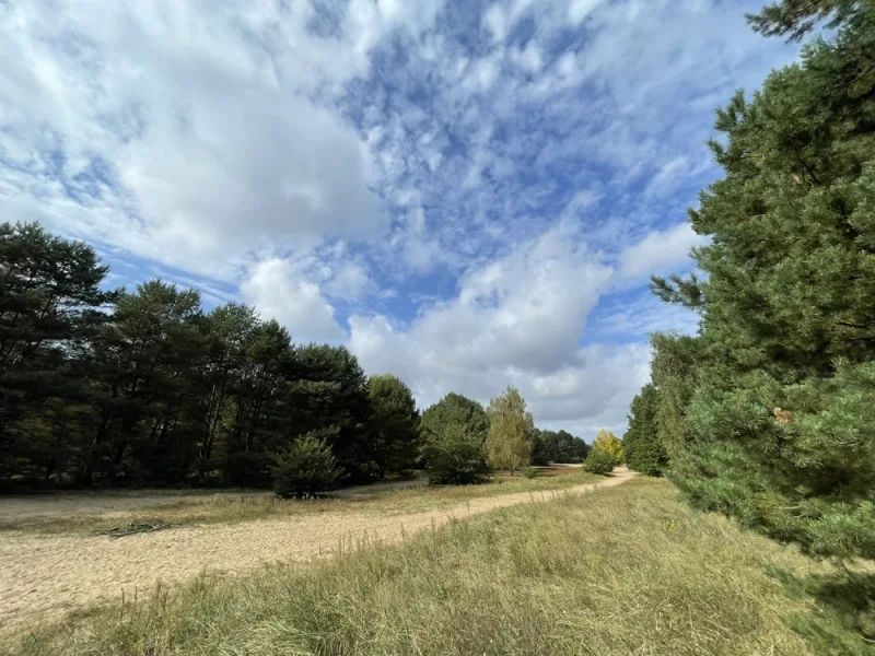
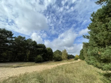
Waldfläche direkt an der Berliner Stadtgrenze auf dem ehemaligen Berliner Mauerstreifen
30.000 €
Kaufpreis
8.206 m²
Nutzfläche
8.206 m²
Grundstücksfläche
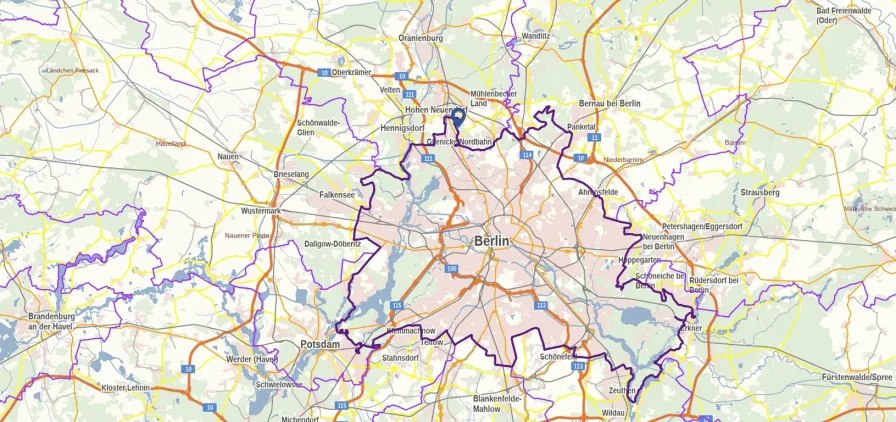
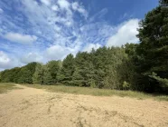
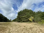
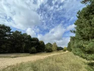
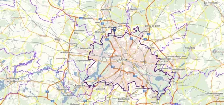
Die zum Verkauf stehende Waldfläche befindet sich im Landkreis Oberhavel, Gemeinde Mühlenbecker Land und grenzt direkt an bebaute Flächen in Berlin Frohnau.
Die ca. 8.206 m² sind Ödland (ohne bzw. nur spärlicher Kiefernbestand) direkt auf dem... mehr lesen
Die ca. 8.206 m² sind Ödland (ohne bzw. nur spärlicher Kiefernbestand) direkt auf dem... mehr lesen
Die zum Verkauf stehende Waldfläche befindet sich im Landkreis Oberhavel, Gemeinde Mühlenbecker Land und grenzt direkt an bebaute Flächen in Berlin Frohnau.
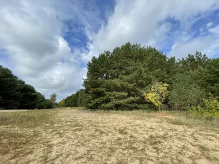
Die ca. 8.206 m² sind Ödland (ohne bzw. nur spärlicher Kiefernbestand) direkt auf dem ehemaligen Berliner Mauerstreifen.
The forest area for sale is located in the district of Oberhavel, municipality of Mühlenbecker Land and borders directly on built-up areas in Berlin Frohnau.
The approx. 8,206 m² are wasteland (without or only sparse pine trees) directly on the former Berlin Wall strip.
Kosten
-
Kaufpreis30.000 €
-
KäuferprovisionKäuferprovision 7,14 % (inkl. MwSt.) des beurkundeten Kaufpreises.
Immobiliendetails
-
NutzungsartAnlage
-
ObjektartJagd- und Forstwirtschaft
-
HauptobjektartLand- und Forstwirtschaft
-
VertragsartKauf
-
Gesamtfläche (ca.)8.206 m²
-
Grundstücksfläche (ca.)8.206 m²
-
Nutzfläche (ca.)8.206 m²
Energie
Lage
Die Bieselheide besteht vorwiegend aus Sandboden, der nahe dem Bieselfließ durch Niedermoor abgelöst wird. Der höchste Punkt mit 62,8 Meter über NN befindet sich in den Loreleibergen, der niedrigste nahe der Mündung des Bieselfließes unter 40 Meter...
mehr lesen
Die Bieselheide besteht vorwiegend aus Sandboden, der nahe dem Bieselfließ durch Niedermoor abgelöst wird. Der höchste Punkt mit 62,8 Meter über NN befindet sich in den Loreleibergen, der niedrigste nahe der Mündung des Bieselfließes unter 40 Meter über NN. Die Bieselheide bedeckte ursprünglich etwa 600 Hektar, wovon heute noch die Hälfte als Wald existiert. Auf aktuellen Landkarten werden aber nur noch die etwa 100 Hektar des Brandenburgischen Teils als Bieselheide bezeichnet. Das Bieselfließ, ursprünglich durch Sickerwasser aus dem Gebiet der Hohen Neuendorfer Rotpfuhle gespeist und den Bergfelder Herthasee durchfließend, mündet bei Glienicke als Kindelfließ in das Tegeler Fließ. Rotpfuhle und Herthasee sind aber inzwischen ausgetrocknet, und das Bieselfließ nimmt nur noch Oberflächenwasser auf.
The Bieselheide consists mainly of sandy soil, which is replaced by lowland moor near the Bieselfließ. The highest point at 62.8 metres above sea level is in the Lorelei Hills, the lowest near the mouth of the Bieselfließ below 40 metres above sea level. The Bieselheide originally covered about 600 hectares, half of which still exists as forest today. On current maps, however, only the approximately 100 hectares of the Brandenburg part are still referred to as Bieselheide. The Bieselfließ, originally fed by seepage water from the area of the Hohen Neuendorfer Rotpfuhle and flowing through the Bergfelder Herthasee, flows into the Tegeler Fließ near Glienicke as the Kindelfließ. However, Rotpfuhle and Herthasee have dried up in the meantime and the Bieselfließ only takes in surface water.
The Bieselheide consists mainly of sandy soil, which is replaced by lowland moor near the Bieselfließ. The highest point at 62.8 metres above sea level is in the Lorelei Hills, the lowest near the mouth of the Bieselfließ below 40 metres above sea level. The Bieselheide originally covered about 600 hectares, half of which still exists as forest today. On current maps, however, only the approximately 100 hectares of the Brandenburg part are still referred to as Bieselheide. The Bieselfließ, originally fed by seepage water from the area of the Hohen Neuendorfer Rotpfuhle and flowing through the Bergfelder Herthasee, flows into the Tegeler Fließ near Glienicke as the Kindelfließ. However, Rotpfuhle and Herthasee have dried up in the meantime and the Bieselfließ only takes in surface water.
16567 Schönfließ · Brandenburg · Deutschland
Die genaue Anschrift erfahren Sie vom Anbieter
Sonstiges
GELDWÄSCHEGESETZ
Als Immobilienmaklerunternehmen ist VON POLL COMMERCIAL Berlin, Lizenzpartner: Kai Seidel Immobilien GmbH nach § 1, 2 Abs. 1 Nr. 10, 4 Abs. 3 Geldwäschegesetz (GwG) dazu verpflichtet, vor Begründung einer Geschäftsbeziehung die... mehr lesen
Als Immobilienmaklerunternehmen ist VON POLL COMMERCIAL Berlin, Lizenzpartner: Kai Seidel Immobilien GmbH nach § 1, 2 Abs. 1 Nr. 10, 4 Abs. 3 Geldwäschegesetz (GwG) dazu verpflichtet, vor Begründung einer Geschäftsbeziehung die... mehr lesen
GELDWÄSCHEGESETZ
Als Immobilienmaklerunternehmen ist VON POLL COMMERCIAL Berlin, Lizenzpartner: Kai Seidel Immobilien GmbH nach § 1, 2 Abs. 1 Nr. 10, 4 Abs. 3 Geldwäschegesetz (GwG) dazu verpflichtet, vor Begründung einer Geschäftsbeziehung die Identität des Vertragspartners festzustellen und zu überprüfen. Hierzu ist es erforderlich, dass wir die relevanten Daten Ihres Personalausweises festhalten – beispielsweise mittels einer Kopie. Das Geldwäschegesetz (GwG) sieht vor, dass der Makler die Kopien bzw. Unterlagen fünf Jahre aufbewahren muss.
PROVISIONSHINWEIS
Mit der Anfrage bei und durch Inanspruchnahme der Dienstleistungen der Firma VON POLL COMMERCIAL Berlin, Lizenzpartner: Kai Seidel Immobilien GmbH, wird ein Maklervertrag geschlossen. Sofern es durch die Tätigkeit der Firma VON POLL COMMERCIAL Berlin, Lizenzpartner: Kai Seidel Immobilien GmbH zu einem wirksamen Hauptvertrag mit der Eigentümerseite kommt, hat der Interessent bei Abschluss
- eines KAUFVERTRAGES oder MIETVERTRAGES die ortsübliche Provision/Maklercourtage an VON POLL COMMERCIAL Berlin, Lizenzpartner: Kai Seidel Immobilien GmbH gegen Rechnung zu zahlen.
HAFTUNG
Wir weisen darauf hin, dass die von uns weitergegebenen Objektinformationen, Unterlagen, Pläne etc. vom Verkäufer bzw. Vermieter stammen. Eine Haftung für die Richtigkeit oder Vollständigkeit der Angaben übernehmen wir daher nicht. Es obliegt daher unseren Kunden, die darin enthaltenen Objektinformationen und Angaben auf ihre Richtigkeit hin zu überprüfen. Alle Immobilienangebote sind freibleibend und vorbehaltlich Irrtümer, Zwischenverkauf- und Vermietung oder sonstiger Zwischenverwertung.
UNSER SERVICE FÜR SIE ALS EIGENTÜMER
Planen Sie den Verkauf oder die Vermietung Ihrer Immobilie, so ist es für Sie wichtig, deren Marktwert zu kennen. Lassen Sie kostenfrei und unverbindlich den aktuellen Wert Ihrer Immobilie professionell durch einen unserer Immobilienspezialisten einschätzen. Unser bundesweites und internationales Netzwerk ermöglicht es uns, Verkäufer bzw. Vermieter und Interessenten bestmöglich zusammenzuführen.
Ansprechpartner

Herr Kai Seidel
VON POLL COMMERCIAL Berlin - Lizenzpartner Kai Seidel Immobilien GmbH
Karlsbader Straße 18,
14193 Berlin
14193 Berlin
Karlsbader Straße 18,
14193 Berlin
14193 Berlin
+49 30 - 49 95 040 0

VON POLL COMMERCIAL Berlin - Lizenzpartner Kai Seidel Immobilien GmbH
Karlsbader Straße 18,
14193 Berlin
14193 Berlin
493049950400
kai.seidel@von-poll.com

VON POLL COMMERCIAL Berlin - Lizenzpartner Kai Seidel Immobilien GmbH
Herr Kai Seidel
